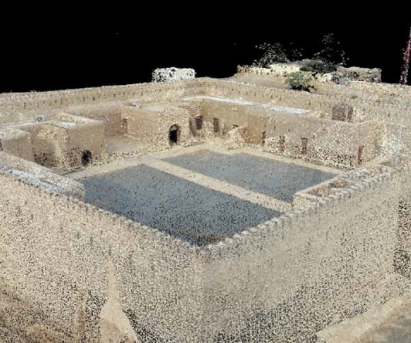
Unlocking Spatial Potential: Aqib Rafiq's Expertise in LiDAR Mapping
With extensive experience in LiDAR technology, I have established myself as a seasoned expert in capturing accurate spatial data and delivering actionable insights. My expertise spans creating precise 3D As-Built Models, Point Cloud Meshes, and Orthomosaics, leveraging advanced LiDAR solutions. From complex infrastructure projects to urban planning and development, I consistently deliver high-quality results, informing strategic decision-making and transforming spatial understanding.

Unlocking Spatial Accuracy: Expert LiDAR Mapping with YellowScan Mapper and DJI L2

Expert Piloting Skills
As a seasoned LiDAR expert, I leverage advanced YellowScan Mapper and DJI L1 technologies to capture precise spatial data. With expert piloting skills, I conduct efficient and safe LiDAR surveys, optimizing flight plans for maximum data quality and navigating complex environments with precision. My extensive experience enables me to adapt to diverse project requirements, ensuring seamless data capture.
Data Capture and Integration
Through my expertise in data capture and integration, I utilize YellowScan Mapper and DJI L1 to generate high-density point clouds. I seamlessly integrate LiDAR data with complementary datasets, including GIS, photogrammetry, and geophysical data, ensuring enhanced spatial understanding. This integrated approach facilitates informed decision-making across various industries.


Technical Expertise
With proficiency in both YellowScan Mapper and DJI L1 LiDAR systems, I optimize data collection and processing workflows to deliver exceptional results. My technical expertise enables me to efficiently capture and process data, providing actionable insights for informed decision-making.
Data Processing and Delivery
Following data capture, I process and refine the LiDAR data to produce precise 3D models, Digital Elevation Models (DEMs), and Orthomosaics. This refined data enables accurate spatial analysis, feature extraction, and data-driven decision-making.

Conclusion
LiDAR technology has revolutionized spatial data acquisition. With expertise in YellowScan Mapper and DJI L1, I deliver precise spatial intelligence, enabling informed decision-making across industries. My piloting skills, data capture expertise, and integration capabilities ensure accurate, reliable, and actionable data.
